Understanding Data
About Environmental Categories
About Environmental Categories
Each dataset in SEED is associated with a Geospatial Category such as ‘Farming’ or ‘Oceans’. This makes it possible to quickly find data for a particular topic of interest. Please note, while a single dataset may be relevant to more than one topic (e.g. a dataset may contain relevant information to both Environment and Biota), it may only be associated with one category.
How to see all the datasets in a category
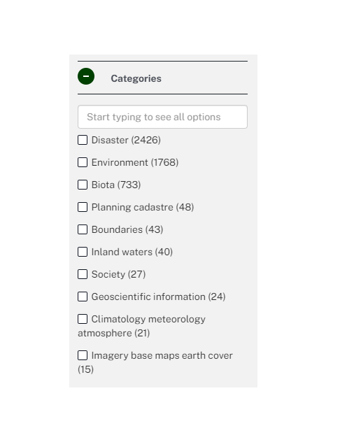
An easy way to see all datasets in a particular category is to make a selection from the ‘Categories’ menu on the left side of the SEED dataset page.
Where do the categories come from?
The SEED categories are taken from the ISO19115 Topic Categories published by the US Geological Survey. The topic categories have been adopted by ANZLIC and provide high-level geographic data thematic classification to assist in the grouping and search of datasets. By using common terminology, we make sure SEED is 'talking the same language' as other sources of environmental data.
Descriptions of categories
The following list of categories is defined by ISO19115 topic categories; not all of these are related to the environment and so may not be currently used in SEED.
|
Category |
Description |
|
Biota |
Flora and/or fauna in the natural environment. Examples: wildlife, vegetation, biological sciences, ecology, wilderness, sea life, wetlands, habitat. |
|
Boundaries |
Legal land descriptions, such as political and administrative boundaries. |
|
Climatology, Meteorology, Atmosphere |
Processes and phenomena of the atmosphere – or ‘weather and climate’. Examples: cloud cover, weather, climate, atmospheric conditions, climate change and precipitation. |
|
Economy |
Economic activities, conditions and employment. Examples: production, labour, revenue, commerce, industry, tourism and ecotourism, forestry, fisheries, commercial or subsistence hunting, exploration and exploitation of resources such as minerals, oil and gas. |
|
Elevation |
Height above or below sea level. Examples: altitude, bathymetry, digital elevation models, slope. |
|
Environment |
Data concerned with environmental resources, protection and conservation. Examples: environmental pollution, waste storage and treatment, environmental impact assessment, monitoring environmental risk, nature reserves and landscape. |
|
Farming |
Rearing of animals and/or cultivation of plants. Examples: agriculture, irrigation, aquaculture, plantations, herding, pests and diseases affecting crops and livestock. |
|
Geoscientific Information |
Information pertaining to earth sciences. Examples: geophysical features and processes, geology, minerals, sciences dealing with the composition, structure and origin of the earth's rocks, risks of earthquakes, volcanic activity, landslides, gravity information, soils, permafrost, hydrogeology and erosion. |
|
Health |
Health, health services, human ecology, and safety. Examples: disease and illness, factors affecting health, hygiene, substance abuse, mental and physical health, health services. |
|
Imagery, Basemaps, Earthcover |
Base maps. Examples: land cover, topographic maps, imagery, unclassified images, annotation. |
|
Inland Waters |
Inland water features, drainage systems and their characteristics. Examples: rivers and glaciers, salt lakes, water utilisation plans, dams, currents, floods, water quality, hydrographic charts. |
|
Intelligence, Military |
Military bases, structures, activities. Examples: barracks, training grounds, military transportation, information collection. |
|
Location |
Positional information and services. Examples: addresses, geodetic (refers to the science of measurement of the earth) networks, control points, postal zones and services, place names. |
|
Oceans |
Features and characteristics of salt water bodies (excluding inland waters). Examples: tides, tidal waves, coastal information, reefs. |
|
Planning Cadastre |
Information that is used to determine appropriate actions for future use of land. Examples: land use maps, zoning maps, cadastral surveys, land ownership. |
|
Society |
Characteristics of society and cultures. Examples: settlements, anthropology, archaeology, education, traditional beliefs, manners and customs, demographic data, recreational areas and activities, social impact assessments, crime and justice, census information. |
|
Structure |
Man-made construction. Examples: buildings, museums, churches, factories, housing, monuments, shops, towers. |
|
Transportation |
Means and aids for conveying persons and/or goods. Examples: roads, airports/airstrips, shipping routes, tunnels, nautical charts, vehicle or vessel location, aeronautical charts, railways. |
|
Utilities, communication |
Energy, water and waste systems and communications infrastructure and services. Examples: hydroelectricity, geothermal, solar and nuclear sources of energy, water purification and distribution, sewage collection and disposal, electricity and gas distribution, data communication, telecommunication, radio. |