On this page, you’ll learn how to use spatial search to find environmental datasets by region.
- To learn how to use simple search, visit How to find data in SEED.
- To learn how to use advanced search, visit How to use the advanced search or query syntax.
You can use spatial map search to view data by:
- Local government area name (LGA)
- Coordinates (latitude and longitude), or
- drawing an area.
How to use spatial search
- Go to ‘search and download data’ to start your search.
- Scroll down to the ‘location’ filter in the left-hand panel.

- Select the map pencil to open the pop-up and choose which search option you want to use
- You can adjust your spatial search at any time by dragging the corners on the map or picking a new location entirely using any method, and clicking ‘Apply’.
Option 1: search by LGA (local government area)
- Select on the dropdown search bar to select the LGA you want to see.
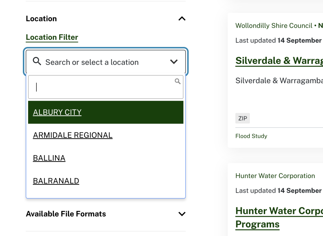
- The search results will update, and the LGA’s latitude and longitude will appear at the top of the results.

- Select and drag the map or use the mouse wheel to zoom in and out of the map.

Option 2: search by coordinates (latitude and longitude)
- Select the map pencil to open it, and enter your coordinates.
- Select apply.
Option 3: search by bounding box
- Click the pencil icon on the map
- Use your mouse to click and drag the map area you want to search, then select 'apply'.
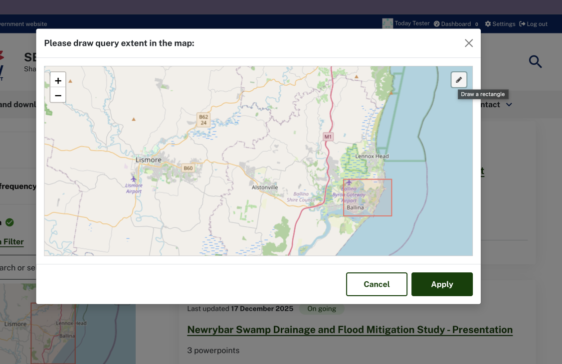
- The search results will update with latitude and longitude at the top of the results.

Save your search
You can save your search and share a link with anyone, anytime. Simply:
- After you have created a search, click the ‘save search’ button in the filters
- Give your search a title and click ‘save search’.
Use the edit pencil or bin to manage your saved searches or share them using the copy link