Search

Biodiversity and Climate Change in NSW

Published on 01 May 2026

Mountain Pygmy possum

Biodiversity across New South Wales is already being affected by climate change. Species are shifting their ranges, breeding and flowering times are changing, and vulnerable ecosystems are becoming less resilient to threats such as bushfires, drought, pests and diseases.  

Connecting users to key findings, projects, datasets, research and tools that support climate‑informed biodiversity management and adaptation planning, the Biodiversity page on the NSW Climate Adaptation Hub explains how climate change interacts with existing pressures to increase extinction risk and alter ecosystems across the state. 

The resources available help users identify vulnerable species and ecosystems, locate potential climate refugia, and guide actions such as habitat protection, restoration and connectivity planning. By bringing together climate risk information and biodiversity data in one place, the Hub supports governments, land managers and communities to make more informed decisions that build resilience and help safeguard NSW’s biodiversity into the future. 

Understanding hillslope erosion in a changing climate

Published on 01 May 2026

https://climateadaptation-hub.seed.nsw.gov.au/article/hillslope-erosion

Hillslope erosion is a major form of soil degradation in New South Wales, occurring when rainfall runoff removes topsoil through sheet and rill erosion. This process can reduce soil health, agricultural productivity, water quality and biodiversity, and is expected to intensify as climate change increases the frequency and intensity of heavy rainfall events.  

The NSW Climate Adaptation Hub brings together the latest science to explain how hillslope erosion occurs, why it matters, and how climate change influences erosion risk across landscapes. 
 

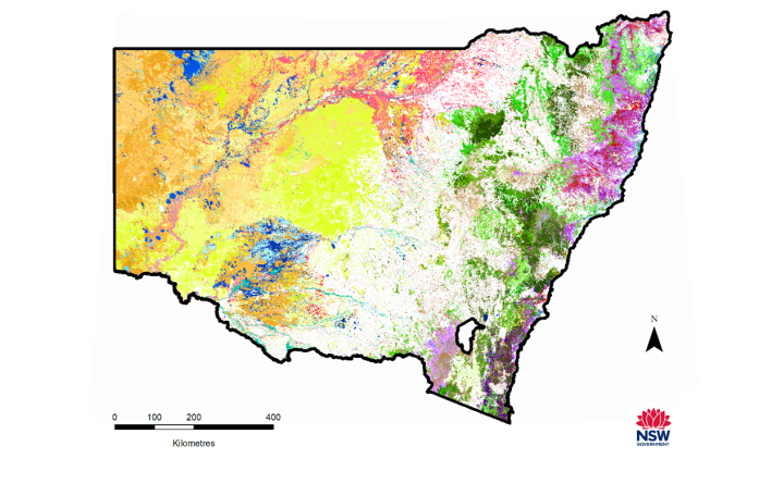
Ensemble means of erosion risk across NSW

 
Figure 1. Ensemble means of erosion risk across NSW from historical to end of 21-century in low (SSP1-2.6) and high (SSP3-7.0) emission scenarios. 

The Hillslope Erosion article supports decision-making by linking climate risk information with statewide data and modelled erosion maps. These resources help governments, land managers, and communities identify erosionprone areas, understand current and future risks, and prioritise adaptation and land management actions. Users can explore spatial datasets, learn how erosion is modelled, and use this knowledge to inform planning, catchment management and onground conservation efforts that protect soils and build resilience to a changing climate.  

Aboriginal Sites Decision Support Tool

Published on 17 September 2021

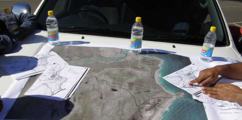
Picture of a Map

The Aboriginal Sites Decision Support Tool (ASDST) has launched new data, version 7.5, which is now available via the SEED portal.

The ASDST is a context setting dataset, supporting planners, heritage professionals and impact assessors expand on Aboriginal Heritage information. The tool extends data from the Aboriginal Heritage Information Management System (AHIMS) by providing contextual mapping data about the likelihood of Aboriginal site features across the landscape.

The ASDST was developed in 2012 by the Office of Environment and Heritage (OEH), the tool is an integrated suite of spatial GIS layers that house pre1750 (original) models, current models, combined accumulated impacts, combined model reliability and combined survey priority. Within these models are specific layers that showcase the predicted likelihood of Aboriginal Heritage Sites, such as stone artefacts, rock art, burials, western mounds and shell, grinding grooves, hearths, coastal middens, stone quarries and scarred tress.

Current ASDST models are modifications of pre1750 data that reflect the likelihood of site features occurring in the present-day landscape. Further, the ASDST has been designed as a landscape continuous tool, unlike the point-based data in AHIMS, which is site-specific. Broadening the lens and capturing a wider view of Aboriginal Heritage Sites is instrumental in providing a regional context to the impact bushfires, climate change and urban expansion have on Aboriginal heritage.

The tool’s capability to illustrate change on a spatial and temporal scale serves as an important guide for decision makers and connects to Aboriginal Cultural Heritage reforms. Additional information about the ASDST and its historical context can be found on EES webpage.

The NSW Broadscale Microplastic Assessment (BMA) Report

Published on 01 May 2026

Microplastic

The dataset represents the best available statewide assessment of microplastic contamination within New South Wales’ estuarine and coastal waterways, marking an Australian-first evaluation on this issue.  

The NSW Broadscale Microplastic Assessment (BMA) report is now available. The study, a three-year partnership between the NSW Environment Protection Authority and the NSW Department of Climate Change, Energy, the Environment and Water (DCCEEW), involved the ranking of 120 waterways by microplastic concentration.  Microplastics were detected in every waterway sampled, demonstrating the widespread nature of plastic contamination across urban, regional, and remote catchments.  

A purpose-designed rapid assessment method was used for the study, developed by DCCEEW scientists under the Marine Estate Management Strategy.   

The research highlights that the Hawkesbury-Sydney region has the highest contamination levels. The Cooks River was found to be the most contaminated of all 120 individual waterways, followed by Dee Why Lagoon, Muddy Creek, Toongabbie Creek, and Throsby Creek—all in densely urbanised areas. 

In contrast, the least contaminated systems were found in minimally disturbed catchments on the state’s north and south coasts, including Myall Lake, Nadgee Lake, Middle Lagoon, Myall Broadwater, and Wallaga Lake. 

This three-year comprehensive study will help environmental authorities understand where microplastics accumulate in our waterways and where to focus risk management actions and future research. To further combat plastic pollution, the NSW Government will introduce a Bill to Parliament in the coming weeks to bring the first actions under the landmark NSW Plastics Plan 2.0 into effect. 

You can interact with the full data package Broadscale Microplastics Assessment dashboard on SEED here. 

Explore the complete Broadscale Microplastic Assessment report via the NSW EPA website 

Featured dataset update: NSW Air Quality Data Services

Published on 28 February 2022

Windmill against blue sky

NSW Air Quality Data Services are the trusted source of air quality and meteorological data in NSW and have recently added some terrific new functions to the NSW Air Quality Dataset, resulting in a more robust and interactive user experience.

Users can now access air quality data in real-time across the NSW air quality monitoring network. Charts containing multiple air quality parameters are available for both Rural (triangle icon) and Standard (circle icon) air quality stations. The colour of the station icon relates to the current air quality category, providing a visual assessment of real-time air quality data across NSW. This handy function can be viewed on the SEED map with the extra option to export data.

Further, the NSW Air Quality Dataset updates air quality status hourly and records daily maximum and daily averages of air quality data, which can be viewed for the last month and last year in a table and chart. Access to robust air quality and meteorological data supports communities, policy, research, and decision-makers to improve environmental and health management outcomes across NSW.


SEED Citizen Science Hub Retirement: Embracing New Engagement Opportunities

Published on 23 June 2023

Sunset

The SEED Citizen Science Hub (CSH) was launched in July 2020 and has been a key component of the Department of Planning and Environment’s (DPE) and SEED’s external citizen science presence, creating a citizen science network that connects people, projects, and data. As of 30 June 2023, the CSH was retired due to limited resources in maintaining the required level of engagement and fulfilling its envisioned intent in serving the goals of citizen science.

While the current form of SEED CSH has been discontinued, the hub infrastructure will be adapted to support the creation of multiple bespoke hubs that incorporate specific data themes to enhance user engagement with their theme and data available on SEED.

Citizen Science remains an important asset to DPE and is widely used across various government programs as a contributor of valuable data, and engages citizens in the scientific process, helping to inform decision-making and promote environmental awareness. Despite the discontinuation of the current form of the CSH, users can continue participating in CS projects and contributing CS data through SEED.

SEED recognises the importance of CS data and remains committed to its value and contribution to scientific research and decision-making. SEED will continue to support making CS data discoverable alongside non-CS data. If you would like more information or guidance on the transition please visit our FAQ page and reach out to [email protected] to link data or for other SEED related enquiries.

We appreciate the ongoing commitment to Citizen Science and its substantial contribution to scientific research, decision-making, and environmental awareness. By embracing these changes, we can ensure the continuity of valuable CS projects and the availability of CS data for years to come.

Header image: Jessica Stokes/DPE

Introducing citations on SEED

Published on 21 August 2023

Citing data image

SEED's core aim is to enable great decisions for the people of NSW with open access, easy to find, and trusted environmental data, insights, and intelligence. With over 5200 datasets, SEED has explored its data's use, uncovering over 220 references in various publications such as reports, journal articles, books, and conference papers.

Committed to continuous improvement, SEED has introduced an innovative citation feature that allows users to seamlessly copy and paste citations into their work, enhancing data integration. This feature also incorporates a "how is this data used?" function that demonstrates where the dataset has been cited, offering valuable insights to both users and data owners. Citation information is accessed on the main dataset search page or on individual datasets and users can link their own research to a dataset for others to view. This supports evidence-based decision-making and provides increased visibility into data usage.

By making citations available and transparent to the people of NSW, SEED offers tangible examples of the impact and contribution open data has on scientific research and governmental decision making. Moreover, SEED is committed to a user-centric, iterative design approach and will continue to work with the people of NSW to provide data, insights and intelligence required for evidence-based environmental decision making.

Header Image: Peter Robey/DPE

Case Study: The Net Zero Emissions Dashboard

Published on 5 October 2023

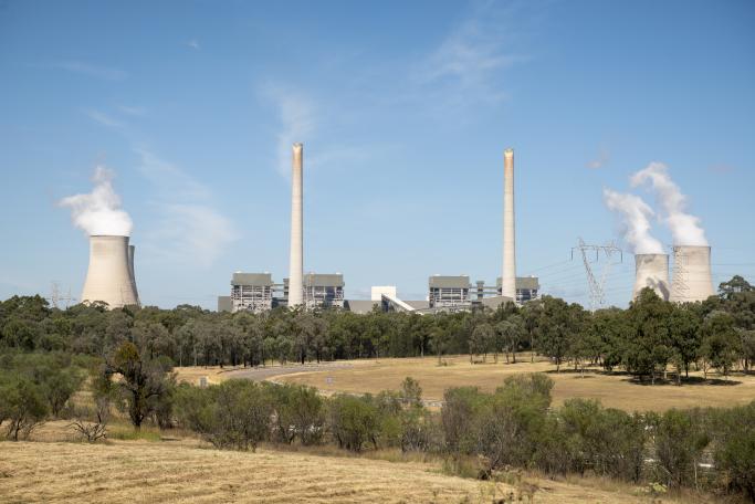
Farmland in foreground with polluting heavy industry in the background.


SEED case studies showcase success stories on key projects, initiatives, and partnerships.

SEED partnered with the Department of Planning and Environment (DPE) Net Zero team to create the NSW Net Zero Emissions Dashboard. The Net Zero team was looking for a unique solution to make important emissions data openly available. To achieve this SEED and the Net Zero team worked together to create a dynamic and interactive tool that allows users to visualise emissions data and derive insights.

To learn more about the creation of the NSW Net Zero Emissions Dashboard, visit the case study here.

Image credit: John Spencer/DPE

Themed Hub Environments on SEED

Published on 17 October 2023

Boat in river

SEED recognises the value and need for themed hub environments created in collaboration with different agencies and organisations to provide a place for the people of NSW to engage with SEED data and see how it is being used, or has the potential to be used in policy, research, and decision-making. To seamlessly connect users with subject-based data, SEED has launched Themed Hub Environments, a new service that fosters a self-sustaining community of practice where business areas and their communities can interact, access SEED data, and collectively derive insights and intelligence.

SEED’s first themed hub, the Water Hub, was developed in partnership with the NSW Department of Planning and Environment Water group (DPE Water). The Water Hub provides a space for the community to explore information, share and collaborate on water data, and facilitates discussion and feedback. The Water Hub is administered by DPE Water, and datasets are sourced live from the SEED portal.  

In line with SEED’s commitment to open data, all datasets within the Water Hub are freely available, and users can access data without the need to create an account or log in. However, creating a profile allows users to participate in forum discussions and receive notifications from the Hub.

The launch of Themed Hub Environments supports SEED’s vision of becoming the single source for relevant, robust, and integrated environmental data, by diversifying the insights, intelligence and communities SEED supports.

If your organisation is interested in this service, please reach out at: [email protected] 

For a tour of the Water Hub, click on the video below:

Image Credit: Peter Katelaris/DPE