The enhanced Layer Intersect Tool (LIT) provides a more intuitive user experience, expanded functionality, and increased flexibility in managing the tool. With a redesigned step-by-step interface, new geometry source options, removal of the restrictive area limit, and now offering compatible SEED Map layers, users can perform more customised assessments—unlocking data insights beyond biodiversity to any spatial data combination.
The enhancements provide:
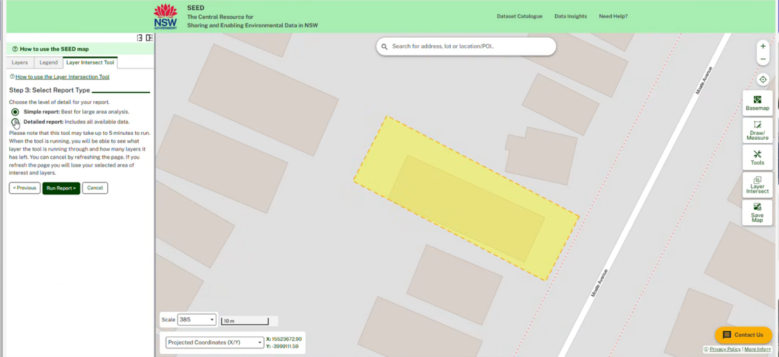
- User Interface Redesign.
The LIT interface has been modified to provide a step-by-step interface with clearer access to tool functionality and Simple and Detailed reports. - A new geometry source is added.
An additional Area of Interest is added, “Select by location,” which allows SEED Map layer features to be used. High-value administrative layers, such as Lot, LGA, National Park, and Regional Planning Areas, will be made available. - Remove the area limitation of 2000 hectares.
The new limitation is the number of records the LIT can process in an acceptable
time. Users run a feasibility check to have an opportunity to refine the area of interest or choose a Simple Report if the area is too large. This allows large AOIs to be used in the tool. - Any compatible layer can be used in the LIT.
A user can select any feature layers in the SEED Map to find ‘what is inside’ my area of interest. This expands the use of the tool from only Biodiversity Assessment analysis to any combination of SEED Map layers.
👉Explore the enhanced Layer Intersect Tool -SEED Map and find out more about how to use the Layer Intersect Tool | SEED Portal.