Finding and using data on the SEED map
Searching for datasets on the SEED map
Searching for datasets on the SEED map
There are two main ways to search for datasets on the SEED map:
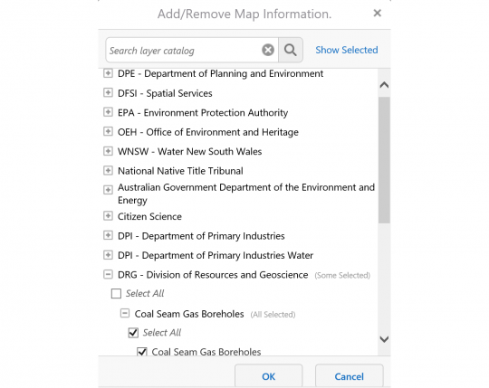
1. Find a dataset by keyword. To do this, select the ‘I want to…’ button, then ‘Layer Catalogue’ and type in a keyword for the dataset you are looking for or browse the options.
Select the + sign next to an organisation to expand it and see the datasets which it manages. Keep expanding through the various layers and select the checkboxes next to any layers you wish to display. Click 'OK' to see the layer(s) displayed in the map.
The legend(s) for the layers will appear in the left-hand panel. If you wish to see the list of layers currently in the map, click the Panel Actions Menu button (with four horizontal lines) at the top of the left-hand panel and select 'Layer List'. From the Layer List, if you select the > button to the right of the layer name then you may have the option to:
- Adjust the opacity (transparency)
- Remove the layer from the map
- Display the metadata for the dataset
- Zoom to full extent
- Zoom to visible extent (for some datasets it is necessary to zoom in on the map before the data will display)
If a layer name appears grey, this means that you are not zoomed in enough to view that layer. The name will turn black when you are zoomed in sufficiently to see the data.
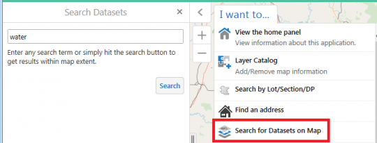
2. Search for datasets on the map. This will do a geographic search of datasets that intersect your current zoom extent.
To do this, go to the SEED map and zoom to your area of interest. Then select ‘I want to… Search for Datasets on Map’. This will enable a search field in the left-hand panel:
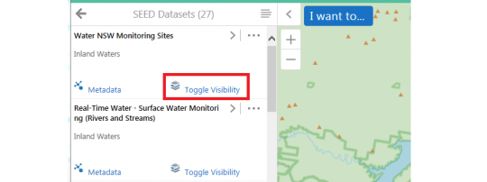
Either leave the field blank (to search for all datasets relevant to the region you can currently see on the map), or enter a search term. Then select the Search button. Any matching datasets will be listed in the left-hand panel.
Each dataset includes an option to ‘Toggle Visibility’ underneath the dataset name. You can select and deselect this to display and remove the data from the map.
Note: some of the datasets will not have the functionality to be viewed on the SEED map. It is currently not possible to remove the ‘Toggle Visibility’ link for these datasets. If you click ‘Toggle Visibility’ for one of these datasets you will get an error message “This dataset does not have spatial data associated with it”. In that case you can simply move on to another dataset to view on the map, or click on the Metadata link for more information about that particular dataset, which may include the option to download the data or view it in other applications (e.g. ArcGIS online or Google Earth).
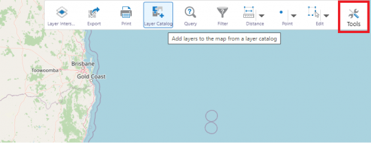
The final method (from within the map) is to select from a list of all datasets grouped by organisation. To do this, select the 'Tools' button then 'Layer Catalog'. (In map terminology, datasets are called ‘layers’ because they display as layers on top of one another.)
This displays a list of the organisations that have contributed data to SEED.
Select the + sign next to an organisation to expand it and see the datasets associated with that organisation. Keep expanding through the layers and select the checkboxes next to any layers you wish to display. Click 'OK' to see the layer(s) displayed in the map.


